
Walking an Imperial Beach Street Directory Trail
Begin with the full delivery line and keep a note of every version found. Imperial Beach streets can appear with a direction, a shortened suffix, a unit, or a parcel description that does not look like the postal line. The aim is not to make one search return a private household list. The aim is to build a record trail in which each source answers one narrow question: where the land is, who holds title, which instruments changed it, and which historical sources place a person at that address.
- Normalize the address. Check the street number, direction, name, suffix, unit and ZIP with the USPS address lookup. Keep the raw version too.
- Find the parcel and owner clue. Search the San Diego County secured roll or a parcel map. Record the APN, situs address and any separate mailing address.
- Trace the deed chain. Use the owner name and later grantor or grantee names in the ARCC index. Compare the legal description, not just a street spelling.
- Check the election source with care. My Voter Status authenticates the person using exact identity fields. It does not publish every registered voter on a street.
- Reach backward through directories. Use a street-order or criss-cross volume for a dated household clue, then pair it with a census, newspaper, or vital record.
This order keeps the Imperial Beach street directory grounded in a parcel before a name is treated as a match. It also makes a wrong turn visible. If an APN changes, a deed description conflicts, or a directory skips a year, the gap is recorded rather than filled with a guess.
Imperial Beach Street Records by Source
Address-keyed records in Imperial Beach sit across city, county, state, library and federal systems. A source may show a titled owner, a project applicant, a registered voter using a self-service tool, or an apparent occupant in a dated directory. Those are different roles. The table keeps the main record sets distinct before they are compared.
| Record Set | Keeper | What It Shows | Access |
|---|---|---|---|
| Secured assessment roll | San Diego County ARCC | Parcel context, assessed value, exemption and assessment-change reason | Online query; owner suppressed; phone or kiosk |
| SanGIS and MapGeo maps | County / Imperial Beach | Boundaries, APNs, layers and street context | Free map tools; anonymous exports limited |
| Recorded documents | ARCC Recorder | Grantor/grantee names, document type, dates, deeds and liens | 1970-present name index; kiosk and copy fallback |
| City permits and code files | Imperial Beach | Project address, permit, applicant, contractor, scope and dates | Tyler/EnerGov, request form or CPRA request |
| County Accela records | San Diego County | Permit and project fields, parcel, professional and business clues | Public search; some applications need an account |
| Voter status | California SOS / SD ROV | The authenticated user’s registration details | Self-lookup; qualified-file rules apply |
| Reverse directories and census | Libraries / NARA | Dated address and household snapshots | Library, scans and census access through 1950 |
The APN is the useful bridge. It can tie a roll entry to a deed or survey record even when a street line changes. A permit applicant, a mailing address, or a directory listing still needs its own check. For one person rather than a whole street, the Imperial Beach resident lookup workflow shifts the focus from parcel coverage to identity matches.
Imperial Beach Secured Roll Search Fields
The San Diego County ARCC secured assessment roll search is an address and parcel starting point. Its public result can show parcel and address context, assessed value, exemption amount, a possible factored base-year value for a Proposition 8 reduction, and the reason for an assessment change. The roll is not a tax bill, and its online ownership display is suppressed.
| Field | Type | Required | Format or purpose |
|---|---|---|---|
| Parcel Number | Radio/mode plus text | One mode | At least 8 digits with dashes, such as 123-456-78 or 123-456-78-90 |
| Address | Radio/mode plus text | One mode | Street number and name; omit the suffix. For parcels without numbers, use the street name alone. |
| Search | Button | None | Runs the secured-roll query using the selected mode |
The 2026 roll uses the January 1, 2026 lien date and is accurate through June 30, 2026; later changes are not reflected. Because the owner is suppressed online, use the Assessor phone at 619-236-3771 or an ARCC office kiosk when ownership or address information is needed. ParcelQuest may allow up to 25 searches in 30 days before a vendor subscription is required, but certified copies still come from ARCC.
The secured-roll search reference helps show why the Imperial Beach street directory begins with a land record rather than a household claim.
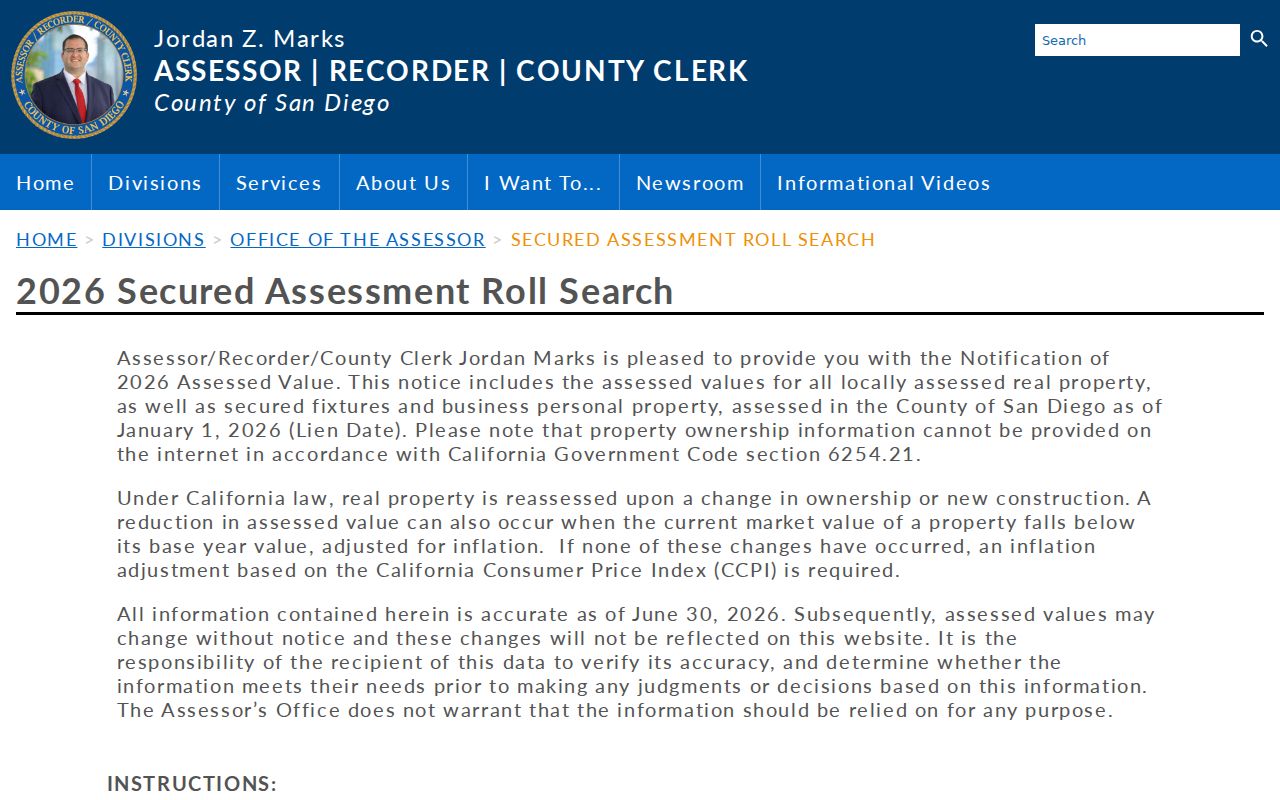
The roll view is most useful when its APN and situs details are carried into the deed and map checks that follow.
Imperial Beach Address Terms and Parcel Maps
SanGIS and the Imperial Beach MapGeo property viewer help turn a street line into a shape on the ground. MapGeo can search an address and, after its disclaimer, show parcel geometry with search, selection, draw, themes and document controls. The SanGIS open-data and county parcel tools add a wider view of adjoining APNs and recorded map references.
MapGeo is a spatial discovery tool, not a public owner directory. In the anonymous view, the abutters panel and spreadsheet, mailing-label and report downloads are blocked. Owner name, owner mailing fields, owner ZIP, APN and assessed-value fields are also suppressed. County assessor maps can show parcel or lot boundaries, adjoining parcels, street widths, dimensions and recorded-map references, but they expressly do not show ownership or addresses. Those limits matter when browsing an Imperial Beach street one parcel at a time.
The SanGIS parcel interface is a good visual companion to MapGeo. The map can keep one subject parcel in view while neighboring polygons are checked, but ownership still comes from the assessor or recorder channel.
- Parcel
- A distinct land unit identified in county systems by an assessor parcel number, or APN.
- Situs address
- The physical location of the parcel. It can differ from the assessor mailing address used for notices.
- Plat
- A recorded map that shows lot, block, subdivision or other land divisions used with legal descriptions.
- Criss-cross directory
- A reverse, street-order directory that places apparent occupants by address for a particular publication year.
The definitions keep an Imperial Beach street directory search from treating a mailing line, a map label and a legal description as the same thing.
The Imperial Beach parcel viewer is especially helpful for locating a subject parcel before a deed chain or permit search.
Use the map for orientation, then move to the custodian that can confirm the record behind the shape.
Imperial Beach Deed Chains by APN
The ARCC Official Records index covers indexed real-property documents from 1970 to the present. Its web route is now grantor and grantee name based. An APN search was removed from the online system on December 9, 2024, under AB 1785, but APN searching remains available at five public kiosks. New records generally appear after about 24 to 48 hours. The web index exposes indexed information, not document images.
Search the current owner name and each prior grantor or grantee, then compare the document number, recording date, document type, APN or legal-property reference, and later reconveyances. A deed index is not a title report, a legal conclusion about present ownership, or proof that a named party occupied the Imperial Beach situs. Full legal descriptions, execution dates and the substance of an instrument require the image or a copy.
The county deed and survey guidance shows why recorded instruments and survey records belong in the same address trail.
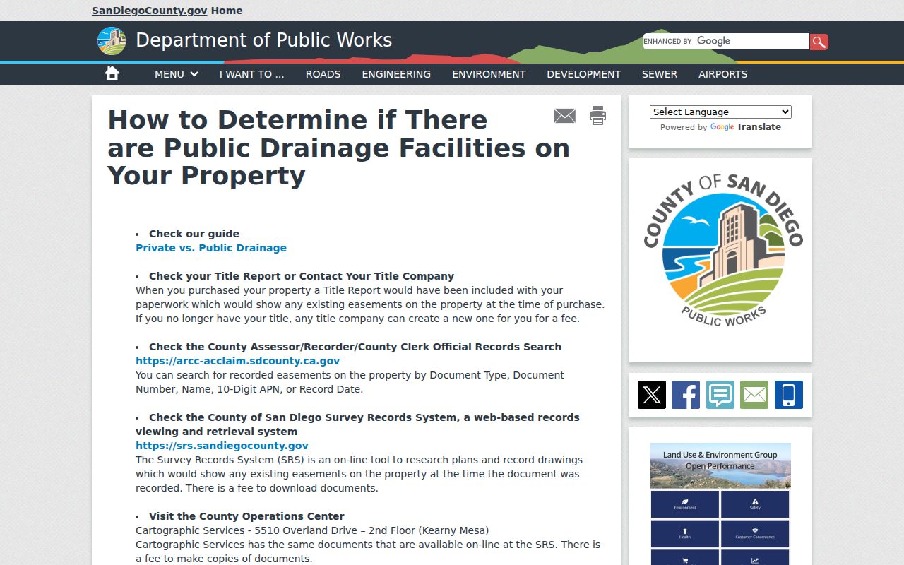
Images are free to view at ARCC public kiosks. Mailed paper copies and counter service remain available, while an online order requires an account, prints the next business day, and normally takes 3 to 5 business days plus mailing. No email or fax image delivery is offered.
The Chula Vista kiosk at 590 Third Avenue is open Monday through Friday, 8 a.m. to 5 p.m., with no appointment required. Ordinary document copies or system-generated reports cost $2 for the first page and $0.05 for each added page, plus $1 for certification. Card payments add $2.50; cash is accepted in person, and check or money order works in person or by mail. The recorder line is 619-238-8158.
Imperial Beach Survey Records Bridge Gaps
A deed trail can stall when a parcel splits, a street line changes, or an older instrument uses lot and block language. The County Survey Records System holds plans and recorded drawings that can connect a present APN to an older subdivision, easement or legal description. Search the current parcel, subdivision, lot and block references together, and note any download fee before relying on a map.
County Archives is the pre-digital fallback at 10144 Mission Gorge Road in Santee. Its researched contact is archives@sdcounty.ca.gov, 619-237-0502, weekdays 8 a.m. to 5 p.m. Physical official-record holdings span 1848-1959, with a bulk of 1873-1931. That older channel matters for Imperial Beach history because the online deed index begins in 1970 and the city incorporated only in 1956.
Imperial Beach Permit Files and Accela Search
City permits can add a dated project clue to an Imperial Beach street directory trail. The city moved building applications, plan review and payments into Tyler/EnerGov. An account is required, and users had to re-register with the same email after the September 14, 2024 authentication migration. City Hall kiosks and staff help are offered Monday through Thursday, 7:30 to 9 a.m. and 3:30 to 5 p.m.; the inspection line is 619-628-1360.
The city’s address-keyed building permit information request form asks for name, email, phone, project address, city, state, ZIP and the building permit inquiry, with an optional request for an emailed copy. A permit applicant or contractor is not necessarily a resident. Use the city route for city-held files and the county route for county departments.
The county Accela form is useful for county environmental, public-works and related records. It is not automatically the complete Imperial Beach building history. Its field inventory is broader than a simple street search.
| Field | Type | Required | Options or format notes |
|---|---|---|---|
| Search type | Dropdown | No | General, Address, Licensed Professional, Record Information, Contact |
| Record ID | Text | No | Wildcard percent sign accepted |
| Record type | Dropdown | No | Controls additional criteria |
| Project name | Text | No | Project label |
| Opened from / to | Date pair | No | MM/DD/YYYY |
| State license number | Text | No | Professional record clue |
| Business name | Text | No | Named business |
| Professional first / last name | Text pair | No | Named professional |
| Street number / fraction / range | Text controls | No | Numeric address parts |
| Direction | Dropdown | No | For example, N |
| Street name | Text | No | For example, Main |
| Type | Dropdown | No | Street suffix |
| Unit number | Text | No | For example, 5 |
| Parcel number | Segmented text | No | NNN-NNN-NN-NN |
| City / state / ZIP | Text controls | No | ZIP-capable search |
| Search / Clear | Buttons | None | Execute or reset |
The county fields let a researcher narrow a project by address, APN, professional or business. They do not turn an applicant name into proof of occupancy.
The County Accela search is most useful after the city permit route has been checked.
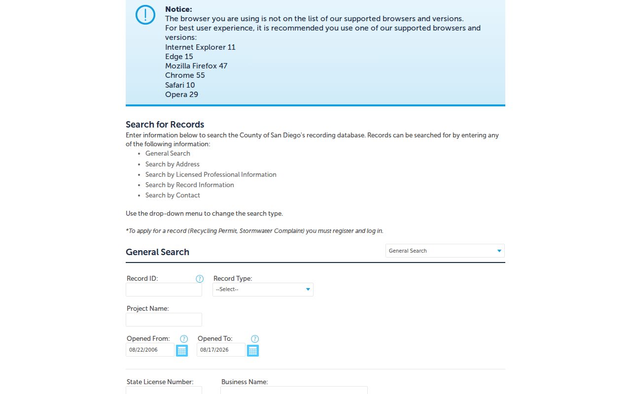
The screen’s address, parcel, city and ZIP controls make a county project search easier to separate from a city permit request.
Imperial Beach Street Grid and Condominium APNs
Imperial Beach has a numbered north-south grid from Third through Fifteenth Streets, crossed by Palm, Donax, Dahlia, Calla, Citrus, Carnation and Imperial Beach Boulevard. The 2024 General Plan describes Palm Avenue and SR-75 entering from the San Diego and Otay Mesa side, with Palm splitting west from SR-75 at Seventh Street. Imperial Beach Boulevard becomes Coronado Avenue at the eastern San Diego city line. Seacoast is a defined mixed-use and residential overlay bounded by the beach and Ocean Boulevard, Ocean Lane, Imperial Beach Boulevard and Palm Avenue.
These clues help a street directory search stay in the right geography, but no official wholesale street-renumbering year or ZIP split chronology was found in the research. Do not invent a renumbering link between an old and new address. Use subdivision maps, lot and block references, the APN and the legal description instead.
Condominiums and other multi-unit sites need extra care. One complex may contain many units and many APNs, while common areas can carry a separate parcel. A numeric sweep down a street can miss unit-level records or count a shared parcel as a home. Search the unit line, then test each distinct APN and compare its legal description.
For block work, adjacent polygons are a map question. For a titled-owner question, the assessor or ARCC is the custodian. For a dated occupant clue, a directory or census is the better fit.
Imperial Beach Reverse Directories and Census
A reverse directory can put an apparent household at an address for one publication year. The entry may include a surname, given name or initial, spouse notation, occupation or listed employer, an r or h residence marker, street address, widow notation, and a business or phone listing. Read the volume’s own abbreviation key first. The exact Imperial Beach entry and complete reverse runs were not verified, so a broad San Diego volume should not be treated as proof that every year covers the city.
- Choose a directory year close to the known address event and search the alphabetical name section.
- Use the street-order pages, when that volume has them, to check the address and nearby entries.
- Compare the street line with the APN, plat or deed description rather than matching a name alone.
- Pair the dated directory clue with a census schedule, newspaper notice, obituary or vital index.
The San Diego City Digital Archives directory collection and the physical shelves at Central Library are useful starting points. The 1950 census is the latest public population census as of 2026 under the 72-year rule. Because Imperial Beach incorporated in 1956, earlier residents may be listed under South Bay, San Diego County, a subdivision or an enumeration district rather than the later city name.
A directory names an apparent adult occupant at a publication date. A deed names title parties. A census names a household at census time. When those records disagree, keep both dates and ask which question each record was built to answer.
Imperial Beach Street Directory Limits
Ownership is not occupancy. An ARCC roll or deed can identify a titled owner, and an assessor mailing address can show where notices go, but neither proves that the owner lives at the Imperial Beach situs. Household members, non-owner occupants, utility customers and DMV address holders are not a dependable public street list. A city permit applicant can be an agent, contractor or project contact.
California My Voter Status is an exact-match, self-authenticated tool for the person using it. The San Diego Registrar of Voters lookup and phone line at 858-565-5800 support voter questions, but Elections Code sections 2188 through 2194 limit qualified voter-file use and do not authorize a published block roster. Safe at Home participants and other protected voters may not appear with a usable address.
For an older question, the honest result may be a gap. A missing directory line can mean a move, death, non-listing, a publication cutoff, a boundary shift or a spelling variant. A missing parcel owner display can mean the web channel is suppressed. A missing voter result cannot be read as proof that no one lived there.
Lawful personal use. Imperial Beach address and deed records are for lawful research such as family history, property history, civic review and scam avoidance. Do not use a street directory to stalk, harass, intimidate, trespass or expose a protected address.
The California Safe at Home program explains why a protected participant’s substitute address must not be reverse-engineered. When the goal shifts from a whole street to one person, use the Imperial Beach resident search workflow and require independent matches.